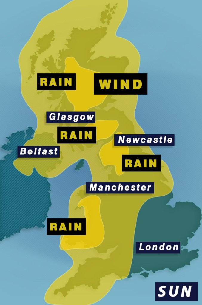
It finally looks like the ‘freeze of the century’ is about to end – but the ice and snow will instead be replaced with rain and wind.
The Arctic blast which ushered in a ‘wall of snow’ from the north is set to be replaced by milder Atlantic air from the west, ushering in warmer temperatures closer to the average for this time of year.
But that Atlantic air will bring low pressure with it, resulting in strong winds and heavy rain which have caused the Met Office to issue several weather warnings on Sunday and Monday.
The weekend and beginning of next week will get off to a wet and windy start, with a wide-reaching yellow warning for wind covering almost the entire UK.
Only the south east of England manages to escape the weather warning, which is in place from 6am on Sunday until 6am on Monday.
A Met Office spokesman explains: ‘Strong winds are expected to develop widely across the UK on Sunday, persisting into early Monday across parts of England and Wales.
‘Within the warning area, many places are likely to see southwesterly winds gust to around 50-60mph and gusts may reach 60-70mph for exposed locations (e.g. coasts).
‘There remains a chance of stronger winds impacting parts of this area for a time but this aspect remains uncertain with further updates to the warning to be expected over the coming days.’
There are also several areas across the UK under a yellow warning for rain.
The rain warnings cover the following areas on Sunday:
The west coast of Wales
Northern England from Lancaster to Carlisle
Southern Scotland from Wigtown to Jedburgh
Central Scotland from Glasgow to Inverness
By Monday, the warnings in Scotland will have expired but the ones covering Wales and Northern England will stay in place until 6am.
The Met Office is predicting 30-50mm of rain to fall on Sunday, with the potential for peaks of 80-100mm over hills.
The Met Office is warning that coastlines will be most seriously affected by heavy winds (Picture: EPA)
They also warn that milder temperatures will allow any lying snow to thaw, which could lead to flooding as rain falls on already saturated ground.
Met Office deputy chief meteorologist David Hayter explained: ‘Conditions will stay cold on Friday but a change in weather type is on the way, bringing milder air for the UK during the course of the weekend.
‘This change will initially be relatively benign in terms of weather impacts, with a dry Friday and start to Saturday for many in the south of the UK.
‘The Atlantic influence will then introduce some wet and windy weather, with a deep area of low pressure approaching from the west on Sunday.


